
Philippine Daily Inquirer
Philippine Daily Inquirer··8 min read
Satellite data help trace Mindanao quake damage, recovery
MANILA, Philippines — More than a week after one of the country’s strongest earthquakes in recent years struck southern Mindanao, scientists are continuing to piece together the scale of the disaster — not from the ground, but from space.
Using radar satellites, high-resolution imagery, shoreline analyses and nighttime light data, the Philippine Space Agency (PhilSA) has produced maps that are helping authorities identify damaged areas, monitor changes to coastlines and track signs of recovery after the magnitude 7.8 earthquake that struck off Sarangani on June 8.
In its latest assessment released June 16, PhilSA said its satellite analyses showed damaged structures in General Santos City, shoreline shifts in parts of Sarangani caused by coastal uplift and the gradual return of nighttime lights in affected communities.
Article continues after this advertisement
The findings build on an earlier June 11 analysis that used nighttime satellite imagery to identify areas that may have experienced significant disruption immediately after the earthquake.
FEATURED STORIES
TECHNOLOGY
TECHNOLOGY
TECHNOLOGY
“The Philippine Space Agency is currently analyzing available satellite data on the 7.8-magnitude earthquake that struck the southern portion of Mindanao on 08 June 2026,” the agency said in a statement.
The magnitude 7.8 earthquake struck at 7:37 a.m. on June 8, with its epicenter located 32 kilometers west of Maasim, Sarangani, at a depth of 33 kilometers, according to the Philippine Institute of Volcanology and Seismology.
READ: EXPLAINER: Why did the magnitude 7.8 Sarangani quake happen?
Article continues after this advertisement
State seismologists earlier said the earthquake was likely associated with movement along the Cotabato Trench, a major earthquake-generating structure off Mindanao where one portion of the Earth’s crust moves beneath another through a process known as subduction.
The earthquake also triggered tsunami waves measuring about 1 meter along the coasts of Kiamba and Maasim in Sarangani and Kalamansig in Sultan Kudarat, while smaller waves were recorded in Mati City and Zamboanga City.
Possible damage in General Santos
One of PhilSA’s latest analyses focused on General Santos City, where satellite images were used to identify areas that may have sustained structural damage.
Article continues after this advertisement
The agency produced maps showing red areas indicating changes to buildings, structures or land surfaces as of June 10.
According to PhilSA, the maps were derived using change detection analysis between Synthetic Aperture Radar images from Sentinel-1C and Sentinel-1D satellites of the European Space Agency.
Radar satellites are particularly useful after disasters because they can gather information even when cloud cover is present.
“PhilSA produced maps showing damaged structures in General Santos City, with areas in red indicating changes to buildings, structures, or the land surface as of 10 June 2026,” the agency said.
The agency said post-event, very high-resolution satellite images also identified specific buildings that sustained damage.
“Post-event very high resolution (VHR) satellite images were able to capture specific buildings in General Santos City that sustained structural damage,” PhilSA said.
To further refine the analysis, PhilSA overlaid radar data with very high-resolution imagery.
“Overlaying the results of the SAR change detection analysis on the very high resolution (VHR) satellite images provides maps with high resolution and wide area coverage showing buildings in General Santos City that likely sustained the most damage,” PhilSA said.
PhilSA, however, cautioned that the findings remain preliminary, noting that the maps are still subject to ground validation.
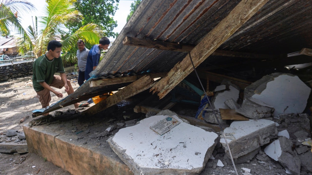
Images from the earthquake’s aftermath had already shown significant destruction across portions of General Santos City, including collapsed buildings and damaged infrastructure.
Among the structures that sustained heavy damage were buildings within the Notre Dame of Dadiangas University compound.
Quake altered parts of Sarangani coast
PhilSA also documented changes along parts of Sarangani’s coastline after the earthquake.
The agency generated maps showing shoreline shifts in Barangays Burias and Pangyan caused by coastal uplift. Coastal uplift occurs when powerful tectonic movements raise portions of land during an earthquake.
“PhilSA also generated maps showing shoreline shifts in Barangays Burias (shown below) and Pangyan, Sarangani, due to coastal uplift following the earthquake,” the agency said.
“In the maps, the shoreline (yellow pre-earthquake, red post-earthquake) is defined as the boundary of the exposed sand. Delineated in green are possibly exposed underwater features,” the agency added.
Scientists generated the maps using visual interpretation and Automated Water Extraction Index analysis of Sentinel-2C satellite imagery acquired on May 10 and June 9.
As with the building damage analysis, PhilSA stressed that “the maps are subject to ground validation.”
When the lights went out
Even before releasing its latest maps, PhilSA had begun studying the disaster using a different indicator visible from space: nighttime lights.
In a June 11 assessment, the agency analyzed nighttime satellite imagery captured at 1:30 a.m. on June 8 and 1:12 a.m. on June 9.
The comparison revealed areas where illumination decreased after the earthquake.
According to PhilSA, these changes can provide a rapid overview of communities that may have experienced significant disruption.
“Changes in nighttime light provide a means to rapidly assess damage, disruption, and recovery after disasters,” the agency said. “When lights go out, it often signals power loss, infrastructure damage, or population displacement/evacuation.”
PhilSA clarified that the analysis was only a proxy and not a direct measurement of damage.
“This preliminary analysis presents a proxy of where the most damage is located based on the absence of nighttime light,” the agency said.
Areas that showed decreases in nighttime illumination included Barangays Labangal, Apopong, San Isidro and City Heights, and the coastal barangays of Siguel and Tambler in General Santos City.
The analysis also identified the coastal municipalities of Maasim and Glan in Sarangani, as well as Polomolok in South Cotabato.
PhilSA noted that these areas cover sizeable populations.
General Santos City has 722,059 residents, according to the 2024 Philippine Statistics Authority census, while Maasim has 67,907, Glan has 117,017 and Polomolok has 176,671.
The agency also said the work remains ongoing.
“PhilSA is in the process of refining and improving this analysis towards identifying the affected areas,” it said.
From disruption to signs of recovery
PhilSA said the same nighttime light data used to identify disruptions may also be useful in monitoring recovery efforts in affected areas.
In its June 11 statement, the agency said, “The return of nighttime lights may also be used as a proxy to monitor reconstruction and recovery.”
The June 16 statement showed that the agency had continued monitoring these changes in the days after the earthquake.
“PhilSA has been monitoring nighttime lights after the earthquake, observing a return of nighttime lights, which may be used as a proxy to monitor reconstruction and recovery,” the agency said.
The agency said changes in nighttime illumination can help assess “damage, disruption, and recovery after disasters.”
“When lights go out, it often signals power loss, infrastructure damage, or population displacement/evacuation,” PhilSA said.
PhilSA researchers, together with researchers from Ateneo de Manila University, have also studied the use of nighttime light data for disaster assessment and recovery monitoring.
In a study shared by PhilSA and conducted with researchers from Ateneo, the team developed a framework that uses nighttime light data to monitor disaster impacts and recovery over time.
The researchers analyzed 12 years of nighttime light data from 281 barangays in Eastern Visayas affected by Super Typhoon Yolanda in 2013.
Their findings showed that nighttime light observations can help track the progression from immediate disaster impacts to long-term recovery, including changes associated with displacement, resettlement and infrastructure restoration.
The study also found that some areas remained below their pre-disaster nighttime light levels more than a decade after Yolanda, underscoring how recovery can unfold over many years.
As communities recover, aftershocks persist
While PhilSA’s analyses provide a broader view of the earthquake’s impact from above, communities across southern Mindanao continue to deal with its effects on the ground.
As of June 18, data from the National Disaster Risk Reduction and Management Council showed that the death toll had risen to 78.
Of the fatalities, 57 were recorded in Region XII, including 33 in Sarangani and 24 in South Cotabato, while Region XI logged 21 deaths, including 20 in Davao Occidental and one in Davao del Sur.
Authorities also reported 30 missing persons and 1,339 injured individuals.
READ: Mindanao quake death toll climbs to 78; 1.5 million affected
The earthquake affected an estimated 357,000 families, or about 1.5 million people.
At least 5,000 families, or about 21,900 individuals, remain displaced and are staying in 47 evacuation centers.
A state of calamity also remains in effect in 14 municipalities across Davao Occidental, Sarangani and South Cotabato.
Damage to public infrastructure has been estimated at P1.29 billion, while losses in the agriculture sector have reached P29.8 million.
The ground has also remained active since the June 8 earthquake.
As of June 16, the Philippine Institute of Volcanology and Seismology had recorded 6,652 aftershocks.
Of these, 1,575 had been plotted and analyzed, while 80 were reported felt by residents in various parts of Mindanao and neighboring areas.
The recorded aftershocks ranged from magnitude 1.2 to 6.4.
READ: More than 6,600 aftershocks recorded a week after Mindanao earthquake
Earlier, Phivolcs said aftershocks could continue for days to weeks following the main earthquake and advised the public to avoid damaged structures and monitor official advisories.
Helping authorities prioritize response efforts
PhilSA said its analyses are intended to support government agencies responding to the aftermath of the earthquake.
According to the agency, satellite data provide wide-area coverage that can help authorities monitor affected areas and identify communities that may require immediate attention.
“PhilSA’s support through the analysis of satellite data provides wide-area coverage that assists the National Disaster Risk Reduction and Management Council in monitoring the situation and prioritizing areas for response,” the agency said.
“By making space data accessible to stakeholders, PhilSA enables informed decision-making and strengthens disaster response,” it added.
The agency said it would continue analyzing satellite data as the situation requires.
“PhilSA will continue monitoring satellite data as the situation requires. Please follow local and national agencies for the latest advisories,” it said. /dm
RELATED STORIES:
PH to launch satellite network to aid agriculture, disaster response
Your subscription could not be saved. Please try again.
Your subscription has been successful.
Ateneo scientists identify 3 Visayas straits as top sites for tidal power
View original source — Philippine Daily Inquirer ↗
Related stories
ABC News
NewsJun 9, 2026 · 1 min
Search for survivors as deadly Philippines quake displaces tens of thousands
ABC News
South China Morning Post
NewsJun 8, 2026 · 1 min
Mindanao quake exposes Philippines’ vulnerability to ‘Big One’ tremor in Metro Manila
South China Morning Post

Philippine Daily Inquirer
NewsJun 8, 2026 · 1 min
6.1-magnitude aftershock hits southern Philippines — USGS
Philippine Daily Inquirer

Philippine Daily Inquirer
NewsJun 8, 2026 · 1 min
LIVE UPDATES: Mindanao earthquake | June 9, 2026
Philippine Daily Inquirer