Indian Express
How India’s roads evolved into the world’s second-largest network
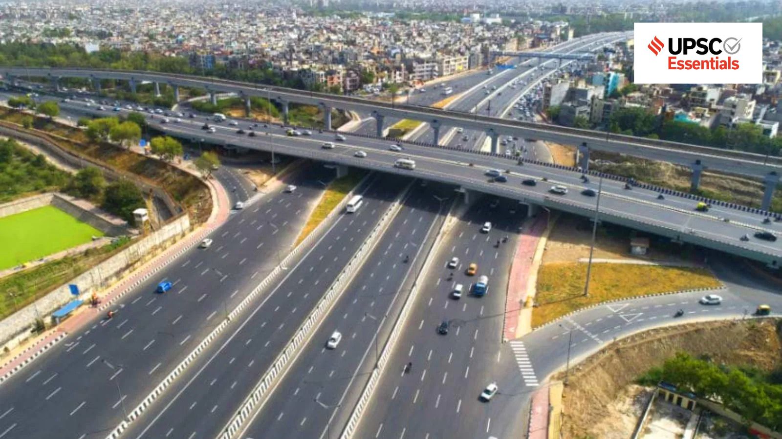
The ruling puts the spotlight on India’s vast road network – the second-largest in the world – which handles 64 per cent of freight and 90 per cent of passenger traffic, according to the Ministry of Road Transport and Highways (MoRTH).
Against this backdrop, let’s explore the evolution of the Indian road network, its modernisation, and the challenges that remain.
The evolution of India’s road network can be broadly divided into three phases, during which the focus of the planning reflects a gradual shift from ensuring basic connectivity to enabling macroeconomic integration, and, more recently, building integrated logistics networks.
The first phase (1943-1998)
The first phase is the blueprint phase, when road planning was led by the IRC (Indian Roads Congress), the apex body of highway engineers established in 1934 to develop nationwide standards for roads. The IRC carried out its projects through successive 20-year Road Development Plans, most notably the Nagpur Plan (1943-1961), the Bombay Plan (1961-1981), and the Lucknow Plan (1981-2001).
During this phase, the goal was to achieve a baseline of road density per 100 square kilometres and classify roads into national and state highways, district and village roads. As the primary objective was to provide basic connectivity and meet numerical targets, the resulting road network was often fragmented and had limited capacity across large parts of the country.
The second phase (1998-2017)
Story continues below this ad
The second phase focuses on connectivity and was largely driven by the economic growth that followed liberalisation measures of the 1990s. The focus now shifted from basic access to high volume transit.
The National Highways Development Project (NHDP) was set up in 1998 to upgrade and modernise India’s national highways. Through the successful development of the Golden Quadrilateral and the North–South and East–West Corridors, the NHDP established India’s primary high-speed, high-capacity highway network.
However, NHDP largely focused on the linear model of widening existing highways rather than developing new highway lines. As economic activity concentrated along the expanded lines, many highways passing through expanding urban settlements developed severe traffic bottlenecks, raising logistics costs and slowing transit.
The third phase (2017-present)
The third phase is marked by the focus on an integrated grid. Recognising the limitations of linear expansion, the remaining phases of the NHDP were merged into the Bharatmala Pariyojana, which aims to connect 550 district headquarters through 4-lane corridor-based highways. This was integrated with the PM GatiShakti National Master Plan, a unified digital platform launched in October 2021 to synchronise multi-ministerial infrastructure planning.
Story continues below this ad
These initiatives represent a shift from point-to-point highway widening to creating a spatial logistics grid. Instead of merely expanding old routes, the focus today is on bypassing congested urban routes entirely through access-controlled greenfield corridors, thereby optimising the nation’s economic geography and making the movement of goods faster and cheaper.
Greenfield and brownfield expressways
Notably, the modernisation of India’s road infrastructure broadly follows two approaches: greenfield construction and brownfield upgradation.
Greenfield construction
The construction of projects on a new alignment is categorised as a Greenfield project. Greenfield expressways are new highways constructed on previously undeveloped land. Since they are planned from scratch, they can bypass heavily congested urban centres and high traffic routes. This enables designing routes with straight alignments, minimal curves, and bankings (superelevation) capable of supporting speeds of up to 120 kmph.
In addition to improving travel time, greenfield corridors can support regional economies by creating new access points for logistics parks, manufacturing clusters, and smart sub-cities along such corridors. While greenfield expressways offer considerable advantages, they also require large-scale land acquisition, substantial investment, and multiple environmental and legal clearances. This often results in delays and disputes over compensation and rehabilitation.
Brownfield upgradation
Story continues below this ad
Brownfield development involves modernisation, widening, and realignment of pre-existing national highways, mainly through upgrading heavily trafficked four-lane highways into six- or eight-lane corridors. These projects utilise the existing right-of-way (RoW) footprint – the total width of land acquired by the government for the construction, operation, and future expansion of a highway.
Brownfield expansion provides immediate relief for the country’s aging economic road network by focusing on routes where commercial traffic chokes local productivity. The primary challenge for the approach, however, emanates from the need to carry out construction while traffic continues to flow. Existing urban development, older bridge layouts, etc., further constrain expansion projects. This suggests that brownfield initiatives can partially address many long-standing bottlenecks.
Recognising these structural limitations, the focus has increasingly been shifted from merely expanding existing highways to designing an integrated network of new economic corridors.
From highways to economic corridors
India’s road-building strategy, particularly under the Bharatmala Pariyojana, maps road construction directly in relation to trade volume. Over 26,000 km of Economic Corridors have been planned to seamlessly connect resource-rich hinterlands with consumption centres through optimised freight routes.
Story continues below this ad
This integration is supported by the PM GatiShakti National Master Plan, a unified GIS-based digital platform that integrates infrastructural planning. By overlaying more than 200 data layers, including forests, existing rail lines, industrial zones, and utility pipelines, the platform seeks to eliminate potential conflicts before construction begins through improved coordination among all involved ministries.
This is part of an effort to move project design from a solely administrative task to a data-driven, multi-modal integration system. Modern highways are designed to act as feeders to other transport modes, intersecting directly with Dedicated Freight Corridors (DFCs), inland waterways, and major international airports to drastically reduce logistical turnaround times.
Challenges in implementation
Despite a clear strategic blueprint, India’s highway modernisation initiatives face significant execution challenges that affect its project timelines and financial viability.
The foremost challenge is the delay in land acquisition. The procurement of land under the Right to Fair Compensation and Transparency in Land Acquisition, Rehabilitation and Resettlement Act, 2013 is a complex process. Fragmented land ownership, disputed land titles, and protracted litigation effectively multiply initial project costs and delay execution.
Story continues below this ad
A second challenge lies in securing environmental and other clearances. Highway projects often require clearances relating to forests, wildlife habitats, and eco-sensitive zones. This often results in delays and escalates project costs.
Financing remains yet another major constraint, as the government shoulders the majority of infrastructure costs. Following the slowdown in private investment due to various reasons, including high risks, the state had to step in with direct funding.
To revive the Public-Private Partnership in construction, the Hybrid Annuity Model (HAM) was introduced. Under this model, the government bears 40 per cent of construction costs while the remaining investment is made by the private developer. Although the HAM helped revive highway construction and expansion, it shifted the large financial burden and long-term costs to public balance sheets.
Towards building faster, sustainable roads
India’s large-scale road infrastructure push reflects a shift in policy – from treating roads just as transport lanes to viewing it as dynamic economic corridors that integrate rural agrarian pockets, tier-2 and tier-3 towns, manufacturing clusters, and maritime ports into a unified domestic market.
Story continues below this ad
However, the success of this strategy depends on policies that take into account the human cost of high-speed transit and the ecological carrying capacity of fragile terrains. Moving forward, the state needs to institutionalise strict eco-engineering solutions, wildlife corridors, and systemic safety protocols, while fast-tracking projects that are environmentally sustainable.
After all, the highway modernisation cannot be measured solely by kilometres constructed, but by how safely and sustainably these corridors co-exist with the regions and ecosystems they integrate.
Post read questions
1. The Supreme Court recently held that the right to walk safely on well-demarcated footpaths is a fundamental right. Examine the implications of this ruling for India’s urban transport and road infrastructure policy.
2. Discuss the evolution of India’s road development strategy since Independence. How has the focus shifted from connectivity to economic integration?
Story continues below this ad
3. Differentiate between greenfield and brownfield highway development. Discuss the advantages and limitations of each approach.
4. Highway modernisation is as much a governance challenge as an engineering challenge. Discuss with reference to land acquisition, environmental clearances and financing.
5. How has the Bharatmala Pariyojana transformed the philosophy of highway planning in India? What role does the PM GatiShakti National Master Plan play in improving infrastructure planning in India?
(Kannan K is a Doctoral candidate at the Centre for Economic and Social Studies, Hyderabad.)
Share your thoughts and ideas on UPSC Special articles with [email protected].
Click Here to read the UPSC Essentials magazine for June 2026. Subscribe to our UPSC newsletter and stay updated with the news cues from the past week.
Stay updated with the latest UPSC articles by joining our Telegram channel – IndianExpress UPSC Hub, and follow us on Instagram and X.
View original source — Indian Express ↗
Related stories

TechRadar
TechnologyJun 22, 2026 · 1 min
The Echo Dot 5th Gen is the best way to take advantage of Alexa+ for cheaper this Prime Day
TechRadar

TechRadar
TechnologyJun 22, 2026 · 1 min
The Garmin Fenix 8 is as cheap as it's ever been
TechRadar

TechRadar
TechnologyJun 22, 2026 · 1 min
Sonic Team head on where the franchise will be in another 35 years — 'Iizuka-san does not think he's going to be alive'
TechRadar

TechRadar
TechnologyJun 22, 2026 · 1 min
Got a Samsung phone? This is my highest-rated Samsung Galaxy Watch, and you should look out for it on Prime Day
TechRadar