Indian Express
What are the environmental challenges of the Chenab–Beas link tunnel project?
A year after putting the Indus Waters Treaty (IWT) in abeyance following the Pahalgam terror attack in April last year, India has fast-tracked various hydroelectric power projects on the western rivers of the Indus basin.
In a significant development, India has recently begun preparations to build an 8.7 km-long water-diversion tunnel, known as the Chenab–Beas link tunnel project, across the Pir Panjal ranges in the Lahaul and Spiti district, Himachal Pradesh, linking the Chandra River, a headwater tributary of the Chenab (western river), to the Beas River (eastern river).
The Chenab is one of the six rivers of the Indus River System, which consists of the western rivers (Indus, Jhelum, and Chenab) and the eastern rivers (Ravi, Beas, and Sutlej). The Indus Water Treaty, signed by India and Pakistan on September 19, 1960, governed the sharing of waters of these six transboundary rivers flowing through the two countries.
In this context, let’s understand the geography of basins, project specifications, and challenges.
Geography of Chenab and Beas basins
The Chandra and Bhaga rivers originate from the southeast and northwest faces of Baralacha Pass (Elevation: 4,850 m), a heavily glaciated region located between the Greater Himalayas and Pir-Panjal ranges of the middle Himalayas in the Lahaul and Spiti district of Himachal Pradesh.
Initially following a south-westerly course, the Chandra River takes a westward turn near Batal (a mountain settlement at 4,000 meters altitude) and continues to the Tandi village, where it meets the Bhaga River to form the Chandrabhaga River. After crossing Pangi valley, the river enters the Paddar area of Kishtwar district of the Union Territory of Jammu and Kashmir, where it is known as Chenab.
Story continues below this ad
Q1. Which one of the following is the largest tributary of the Indus River System?
(a) Ravi
(b) Beas
(c) Chenab
(d) Jhelum
From Akhnoor in Jammu and Kashmir, Chenab enters the plains of Pakistan’s Punjab province in the Sialkot district. There, Chenab successively meets Jhelum and Ravi before merging with Sutlej (which already carries the waters of Beas) and forms the mighty Panjnad river (Five Rivers). Panjnad subsequently joins Indus at Mithankot in Pakistan. Chenab (974 kms), with its total catchment of about 67,430 sq. km., is the largest tributary of the Indus system.
The Beas River originates in the Pir Panjal Range at Vyas Kund near Rohtang Pass, Himachal Pradesh. It spreads over 20,303 sq. km. and flows towards Punjab for about 470 km before meeting the Sutlej at Harike. The Beas River Basin has a potential of nearly 5,000 MW among 51 hydropower projects (more than 5 MW), including Parbati, Dehar, and Pong Dam.
India’s hydropower push on western rivers
Beas, Ravi, and Sutlej (the three eastern rivers) have a total annual flow of approximately 33 MAF, while Indus, Jhelum, and Chenab (the western rivers) allocated to Pakistan have an annual flow of approximately 135 MAF (80% of the tidal water of the Indus river system).
Story continues below this ad
Under the Treaty, India has unrestricted rights to use the waters of the eastern rivers, and Pakistan has control over the western rivers. But the Treaty also permits India to create water storage capacity of up to 3.6 million acre-feet (MAF) on the western rivers for limited, non-consumptive and with certain conditions for agricultural purposes and the generation of hydroelectric power.
Despite these provisions, India did not build any major storage dam on the western rivers to fully utilise its permissible share of water. Many of India’s “run-of-river” hydroelectric projects (HEPs), like Kishanganga and Ratle, have fallen into the multi-tiered, long-drawn dispute resolution mechanism due to Pakistan’s systematic objections.
“Run-of-river” projects refer to the mechanism of producing hydroelectricity by capturing kinetic energy carried by river water at places of natural elevation change. Unlike conventional dams, these projects do not require massive artificial reservoirs and other such water storage capacities.
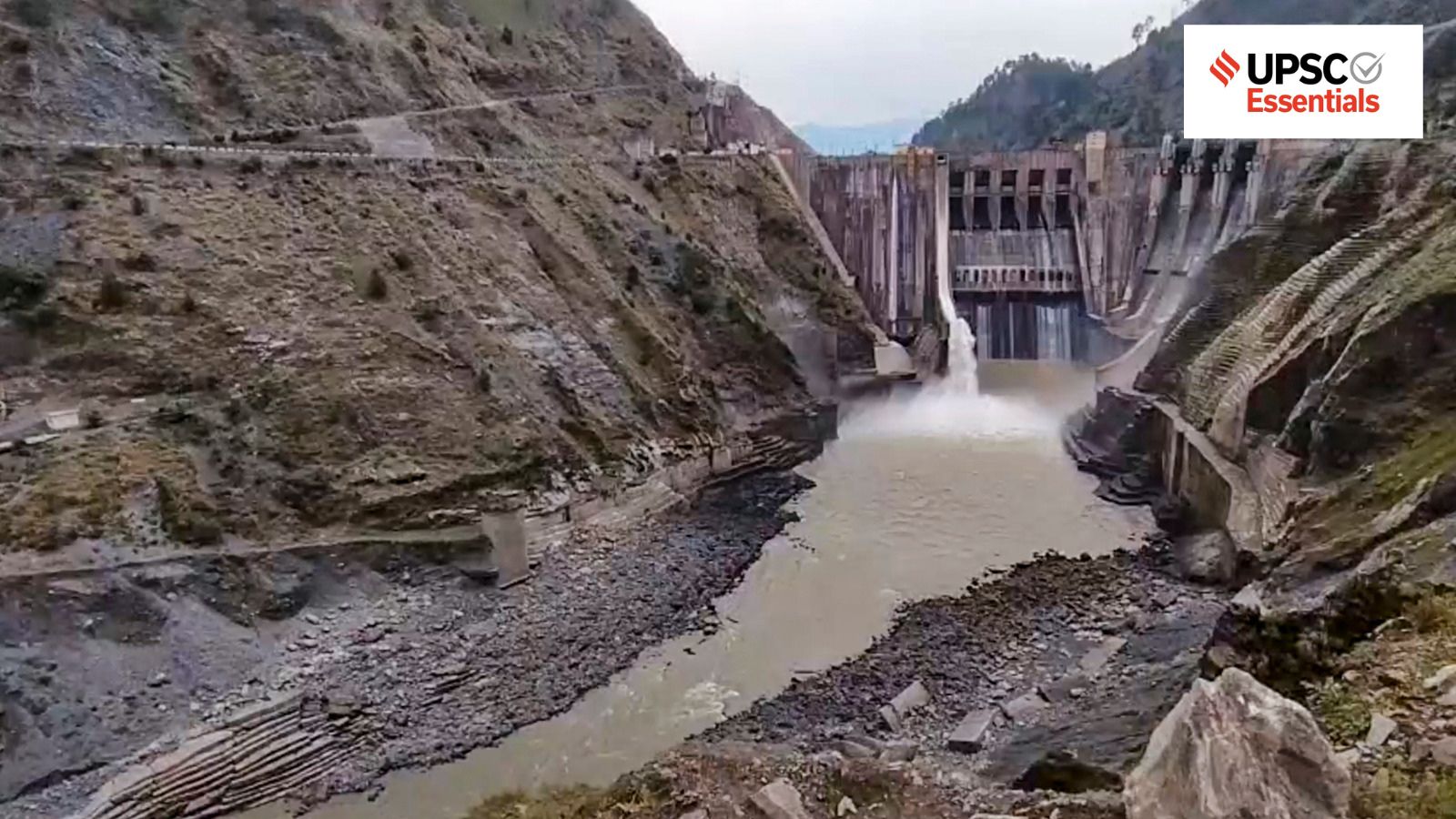
But with the Indus Water Treaty in abeyance, India has expedited the completion of at least four major hydropower projects on the Chenab basin. The aim is to commission the Pakal Dul (1,000 MW) and Kiru projects (624 MW) – both in Kishtwar, Jammu and Kashmir – by December 2026, Kwar project (540 MW) by March 2028, and fast-track the work at Ratle project (850 MW).
Story continues below this ad
Estimates suggest that Jammu and Kashmir has a total hydropower potential of around 18,000 MW, of which only 3,540.15 MW has been harnessed to date. However, after commissioning Pakal Dul and the Kiru hydroelectric projects, it is expected to rise to about 5,164.15 MW by December 2026.
Q2. With reference to the Beas River, consider the following statements:
1. It originates at Vyas Kund near Rohtang Pass in the Pir Panjal Range.
2. It originates in Himachal Pradesh.
3. It is a tributary of the Ganga River.
Which of the statements given above is/are correct?
(a) 1 and 2 only
(b) 2 and 3 only
(c) 1 and 3 only
(d) 1, 2 and 3
Chenab–Beas link tunnel project
In another significant development, India is planning to build a large inter-basin (Chenab–Beas) water diversion tunnel in Lahaul and Spiti district of Himachal Pradesh. National Hydroelectric Power Corporation (NHPC) invited an e-tender for the Chenab-Beas Link Tunnel Project in May this year. The estimated cost of the project is 2352.17 crore, and it aims to be completed within four years and one month.
Story continues below this ad
This proposed tunnel will divert surplus water from the Chandra River towards the Beas basin. In the first phase, a 19-metre-high barrage will be constructed across the Chandra River near Koksar village (elevation 3140 mts) in the Lahaul valley. The surplus water will then be diverted towards the Beas basin through an 8.7 km-long water conveyance tunnel.
Currently estimated annual flow of Chenab is about 35 MAF, and water diverted through this project will be even below 1 MAF in volume. This additional water could help address water-related concerns in states such as Punjab, Haryana, and Rajasthan to some extent. This additional water will add 4,000 MW of hydropower generation capacity in the Beas basin.
But the project raises important environmental concerns, particularly in the ecologically fragile Himalayan region where climate-induced extreme weather events have become increasingly frequent.
Environmental risks and challenges
In recent years, parts of Himachal Pradesh, Jammu and Kashmir, and Uttarakhand witnessed a spike in extreme weather events, including flooding, avalanches, and landslides. Last year, monsoon-related disasters in Himachal Pradesh alone caused hundreds of deaths and injuries and severely damaged roads and infrastructure.
Story continues below this ad
The proposed Chenab-Beas link tunnel is located close to the existing Atal tunnel near Rohtang Pass. Drilling and blasting near an existing tunnel may make the region seismically vulnerable, as it lies in the highest risk Zone VI for earthquakes and related hazards.
Another challenge is the declining storage capacity of downstream reservoirs due to siltation. The gross storage capacity of major reservoirs such as Bhakra and Pong has already been reduced to 26 per cent and 14 per cent, respectively.
Additionally, several studies have pointed towards changing precipitation patterns and rising liquid precipitation in summer monsoon in these Higher Himalayan regions. In recent years during the monsoon, Beas experienced severe flooding. Therefore, channelising additional water from Chenab downstream could also be a serious challenge.
Climate change and the future of the Indus Basin
With the Indus Water Treaty in abeyance, India is trying to build physical infrastructure for the maximum utilisation of its available share of water. This will require not just new tunnels and barrages, but the desilting of silted reservoirs and new storage capacity downstream.
Story continues below this ad
While the Treaty allows India to utilise the western rivers for specified purposes, it doesn’t permit it to divert flows of water from any of these rivers. This may add another dimension to already soured relations between both upper and lower riparian countries.
Moreover, snow and glacial melt contribute about 60 per cent of the water in the Indus basin. A study suggests that between 1960 and 2005 alone, the basin lost about 33.3% of its glacial volume. Hence, current challenges of climate stress, shrinking glaciers, increased frequency of extreme events, more population, and higher clean energy demands indicate an urgent need for revisiting this 65-year-old treaty.
In the long run, accepting the realities of changing climate, alongside the shared geography of the transboundary river system, might help in finding an amicable solution.
Post readd questions
Climate change has fundamentally altered the hydrology of Himalayan river systems. In this context, evaluate the relevance of the Indus Waters Treaty in the 21st century.
Story continues below this ad
What are the legal, hydrological, and geopolitical implications of putting the Indus Waters Treaty in abeyance?
Discuss the geographical characteristics of the Chenab and Beas river basins and examine how they influence the feasibility of inter-basin water transfer projects.
What are run-of-the-river hydroelectric projects? Examine their advantages and limitations in the Himalayan region.
Why are large infrastructure projects in the Himalayan region particularly vulnerable to environmental hazards? Discuss with suitable examples.
(Abhinav Rai is a Doctoral candidate at the Department of Geography, Delhi School of Economics, University of Delhi.)
Share your thoughts and ideas on UPSC Special articles with [email protected].
Click Here to read the UPSC Essentials magazine for June 2026. Subscribe to our UPSC newsletter and stay updated with the news cues from the past week.
Stay updated with the latest UPSC articles by joining our Telegram channel – IndianExpress UPSC Hub, and follow us on Instagram and X.
View original source — Indian Express ↗
Related stories

The Punch
TechnologyJul 6, 2026 · 1 min
Sam Larry alive, responding to treatment after fatal auto crash, says associate
The Punch
The Punch
TechnologyJul 6, 2026 · 1 min
Microsoft cuts 4,800 jobs in Xbox overhaul
The Punch

ZDNet
TechnologyJul 6, 2026 · 1 min
I tested the new Claude Desktop on Linux - here's how it compares to rival apps
ZDNet

The Verge
TechnologyJul 6, 2026 · 1 min
I’m just doing my job, but turns out, it feels lousy holding other people’s privacy in your hands
The Verge