
Philippine Daily Inquirer
Philippine Daily Inquirer··1 min read
Cyclone likely to enter PAR on Saturday, may trigger 'habagat'
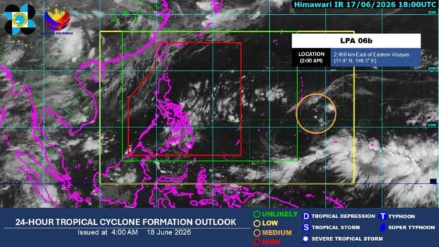
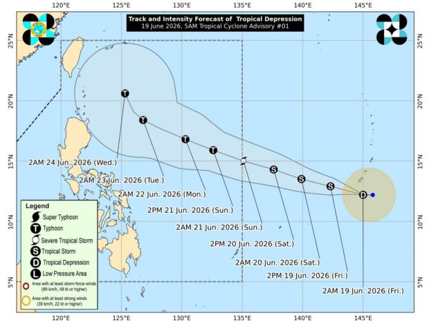
MANILA – The low pressure area (LPA) outside the Philippine Area of Responsibility (PAR) has developed into a tropical depression, the weather bureau said Friday.
The Philippine Atmospheric, Geophysical and Astronomical Services Administration (PAGASA) said the cyclone is forecast to enter PAR on Saturday.
Once inside the PAR, it will be named Francisco.
READ: PAGASA: Rainy season begins
PAGASA said the cyclone packs maximum sustained winds of 55 km per hour near the center and gusts of up to 70 kph.
It was located 2,085 km. east of Eastern Visayas as of 4 a.m., moving west at 15 kph.
PAGASA said the cyclone could intensify into a tropical storm within Friday and may reach the typhoon category by Sunday.
While it is less likely to make landfall, PAGASA said the hoisting of wind signal no. 1 over the eastern portions of northern Luzon is not ruled out.
READ: Pagasa declared rainy season. But where are the rains?
PAGASA also said the cyclone is less likely to directly affect the country’s weather and sea conditions in the next three days.
However, it could trigger the resurgence of the southwest monsoon or habagat by Sunday.
Meanwhile, the country is forecast to continue experiencing isolated rain showers due to the easterlies and localized thunderstorms on Friday.
Light to moderate winds and slight to moderate seas will prevail throughout the archipelago, PAGASA said. (PNA)
Your subscription could not be saved. Please try again.
Your subscription has been successful.
Read Next
Disclaimer: The comments uploaded on this site do not necessarily represent or reflect the views of management and owner of Cebudailynews. We reserve the right to exclude comments that we deem to be inconsistent with our editorial standards.
View original source — Philippine Daily Inquirer ↗
Related stories
Philippine Daily Inquirer
NewsJun 17, 2026 · 1 min
LPA outside PAR has even chance to be tropical depression
Philippine Daily Inquirer

Philippine Daily Inquirer
NewsJun 17, 2026 · 1 min
LPA outside PAR has ‘medium’ chance of turning into tropical depression
Philippine Daily Inquirer
Philippine Daily Inquirer
NewsJun 18, 2026 · 1 min
Tropical depression east of Visayas may enter PAR by weekend
Philippine Daily Inquirer
The Guardian
NewsJun 18, 2026 · 1 min
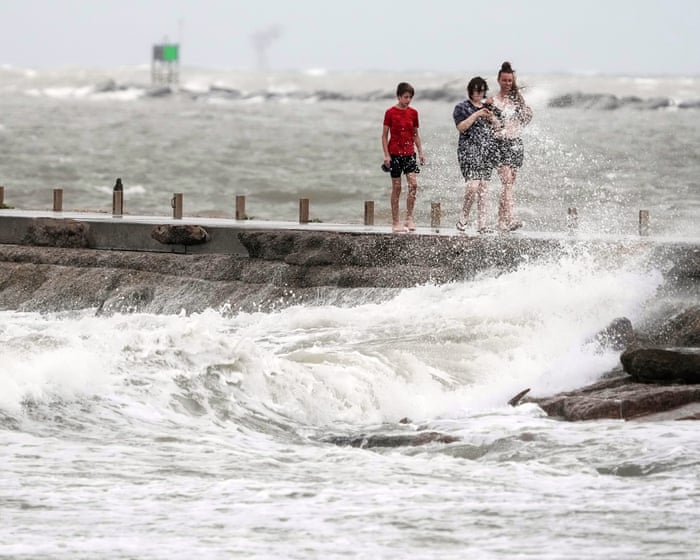
Tropical Storm Arthur downgraded from cyclone as it makes landfall in Texas
The Guardian